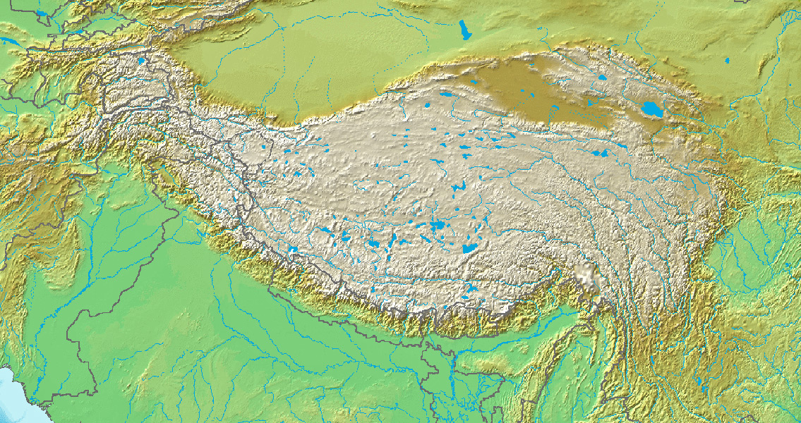
<![CDATA[A study of rock sediments near China's Yellow River could lead to a drastic rewrite of earth's climate history. Two groups of researchers from the Universities of Uppsala and Lanzhou, led by Dr. Thomas Stevens and Dr. Junsheng Nie respectively, have analysed Yellow River sediment from source to sink and determined its mineral composition. They've also successfully determined the age of mineral grains of zircon, a silicate material which is immune to the effects of weathering. Deposits of eroded sediment, which have been transported from rivers to ocean floors, are often used as a means to reconstruct how global climate and topography have developed over millions of years. The results of the new study, published in the journal Nature Communications, are hugely significant as the Yellow River's sediment load, which is currently the world's highest, has long been a key component in attempts by scientists to understand the history of the climate of the Tibetan Plateau and the world in general. As the study explains, "The river’s sediment sources, transport and dispersal patterns, as well as its formation history, are key for understanding the controversial timing, cause, extent and impact of uplift and denudation of the Northeast (NE) Tibetan Plateau and tectonic–climate linkages." Estimates for the establishment of the current drainage pattern for the river are incredibly diverse, ranging from the Eocene to the late Pleistocene. The river's dust archive, which makes it such a vital resource for understanding global climate, is generally believed to be loess deposits which were transported to the bend of the river from the Chinese Loess Plateau, a region which includes modern day Tibet, western China and Mongolia. As the study observes "The Yellow River is considered to be a net remover of sediment from the Loess Plateau." Remarkably, the scientists discovered that the sediment from the Yellow River had gone through drastic change after passing through the Loess Plateau. Just as significantly, contrary to normal belief windborne loess was not the main source of the sediment. Rather, they determined that the Loess Plateau acted as a sink for Yellow River material eroded from the Tibetan plateau. "These findings that the NE Tibet-derived sediments of the upper reach are stored on the Loess Plateau and the western Mu Us desert after 3.6 Myr ago requires a fundamental change in our understanding of the origins of Chinese loess dust and the impact of the Yellow River on the Chinese Loess Plateau". The authors write in the study, highlighting just how dramatic their findings could prove to be. The findings of Stevens et al lead to a complete rethink of how we understand the formation of the Chinese Loess plateau, which in turn could lead to reconsideration about narratives of historic climate change. "This not only casts new light on the origins of Chinese loess but it undermines the principle of using marine sediment to infer terrestrial denudation and to understand the complex relationship between denudation and climate change. Furthermore, our data suggest that increased NE Tibet denudation recorded in Yellow River-derived sediment on the Loess Plateau is a potentially important driver in Pliocene climate cooling." For more information: www.nature.com/ncomms Image courtesy of Wikimedia Commons user: ]]>
Does Earth's Climate History Need to Be Rewritten?