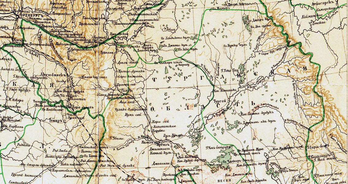
<![CDATA[They’re called the Nazca lines of Kazakhstan by archaeologists – mounds of earth and timber stretching across northern Kazakhstan forming hundreds of giant geoglyphs. Recognizable only from the air, the geoglyphs are laid out to form an assortment of geometric shapes, such as squares, crosses, rings, and even a swastika (an ancient symbol that’s been used for at least the last 12,000 years). NASA recently released satellite pictures, taken from 430 miles up, of some of the figures and is assisting in the effort to piece together this ancient landscape by revealing even more of the massive earthworks. The first geoglyphs, around 50 of them, were spotted in 2007 on Google Earth, and although 260 geoglyphs have now been identified the discovery has failed to attract the significant funding needed for further research. Garnering NASA’s attention could mobilize support to continue the investigation. The only fact known about the geoglyphs is that they were built by ancient cultures, but why they were built and by whom continues to be a mystery. As recently as last year archeologists from universities in Kazakhstan and Lithuania used aerial photography and ground-penetrating radar to reveal shapes ranging from 295’ to 1312’ feet in diameter made up almost entirely of earthen mounds. The swastika, by contrast, was the only shape to be constructed using timber. Formal dating hasn’t been completed, however the characteristics of the structures indicate an age between 2,000 and 8,000 years old. Despite a plethora of research on these amazing creations, the purpose of the geoglyphs remains elusive and a source of conjecture by researchers. While some scientists argue that several of the symbols represent night-sky constellations and are linked to the heavens, other experts contend the lines were part of a pilgrimage, providing a path to a sacred place. Another idea portends that the lines are somehow connected to water, something vital to survival and yet scarce in the desert, and water-based rituals. Excavations by archeologists at the Kazakhstan geoglyph's location have revealed remains of hearths and structures signifying the possibility that rituals had taken place there. The ancient structures are concentrated around Turgai, which is a region in Kazakhstan. 100 Million years ago, during the Cretaceous Period, Turgai was divided by a strait from the Mediterranean Sea to the Arctic Ocean. During the Stone Age, tribes ventured to the steppe's rich land looking for hunting grounds. From 7,000 BCE to 5,000 BCE the Mahandzhar culture thrived there, and could be connected to the older figures. Scientists however aren’t convinced that a nomadic tribe, which the Mahandzhar were, would have stayed in one place long enough to harvest and lay the timber used for ramparts, or dig out the lake bed sediments used to build the massive mounds which were originally six to ten feet high. They now measure almost 40 feet in diameter and 3’ high. Following a report from the international news agency Kazinform that road construction through the area had caused irreparable damage to some of the geoglyph sites, scientists from Pittsburg University began the process of getting the sites UNESCO world heritage designation. This designation will provide protection for the geoglyphs as important archaeological sites. ]]>
NASA Photographs Nazca Lines of Kazakhstan