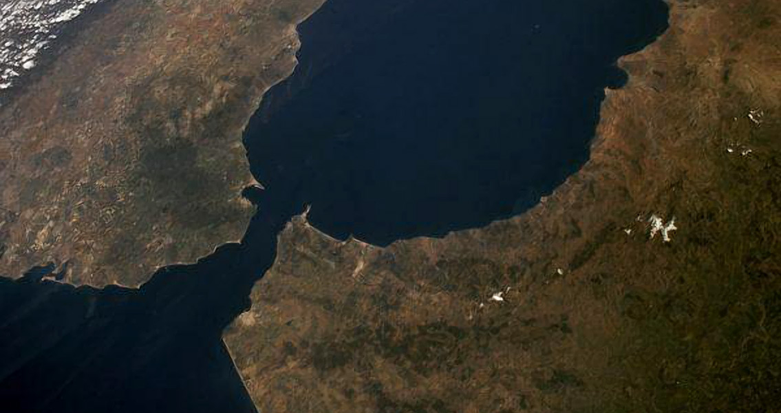
<![CDATA[A team of scientists from the autonomous region of Andalusia in southwestern Spain has been able to reconstruct the ancient configuration of the Gibraltar arc as it stood 9 million years in the past. One of the narrowest landforms on Earth, the Gibraltar Arc is the large, semicircular sweep of southern Spain and North Africa which meets at the Strait of Gibraltar, the transition point between the Atlantic Ocean and the Mediterranean Sea that at its narrowest is less than 9 miles across. The English Channel, for comparison, is more than 20 miles wide at its narrowest. The Arc and the Strait were formed by tectonic movement; the exact movements are part of what a team of scientists, spearheaded by researchers from the University of Grenada (UGR), have discovered. These researchers have found evidence that the Arc was created by the movement of large land blocks measuring some 300 kilometers by 150 kilometers. The northern block, the Baetic System mountains in Spain, rotated clockwise into place; the north Moroccan Rif mountain range rotated counter-clockwise to form the southern boundary of the Arc. According to a UGR press release, these movements happened very quickly on the geological time frame, spinning at a rate of 6 degrees every million years. The Western Baetic System block alone swung 53 degrees. Matching research data with modern GPS-measured tectonic movement places the opening of the Strait at the previously-established date of around 5 million years ago. The team of geological researchers, which in addition to those from the UGR included Seville’s Pablo de Olavide and the Andalusian Earth Sciences Institute, took a close look at the existing connections between the different episodes of geological restructuring and deformation that the Rif and Baetic mountan ranges have undergone. This includes the ridges and folds that would have been formed during this process. Previous publication data concerning the paleomagnetism of the region was also used in the analysis. According to the UGR’s Ana Crespo-Blanc, lead researcher for the project, the resultant work is the first instance of displaying not just the homogenous nature of the rotations of the northern and southern blocks but also the speed these blocks rotated to form the Gibraltar Arc. Furthermore, the research permits the reconciliation of previous data that seemed to be contradictory, especially in regards to kinematic markers indicating the movements of fault systems and other large geological structures nine million years in the past. The culmination of the group’s research includes a reconstruction of the Gibraltar Arc as it would have stood at that point in time, something the researchers characterize as a “key moment” in the geological history of the Iberian subcontinent colliding with northern Africa. This event occurred shortly before the outlet between the Mediterranean and the Atlantic was closed. At this point, the Gibraltar Arc would have been situated much further to the East than it is at present. The new research study, which has recently been published in the journal Tectonophysics, can be found online at Science Direct Image courtesy of NASA ]]>
Scientists Reconstruct Ancient Configuration of Gibraltar Arc