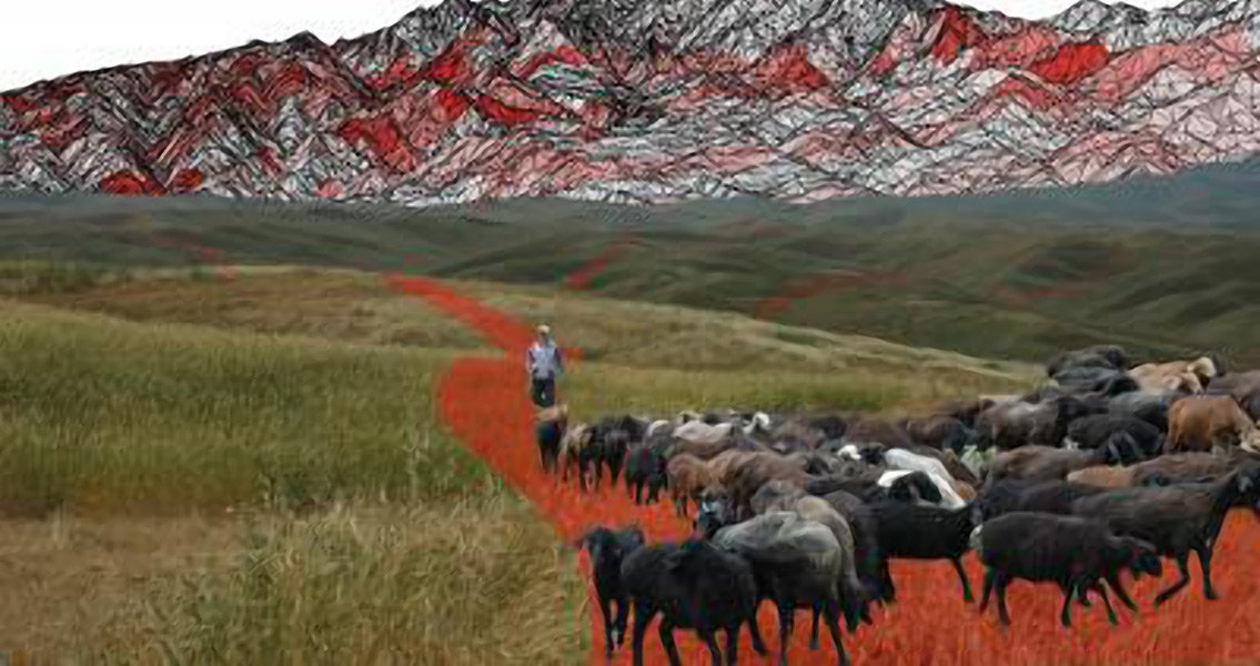
<![CDATA[New research shows that the vast network of east-west trade routes collectively known as the Silk Road, originated as the trails that nomads followed 5,000 years ago as they moved their livestock between mountain pastures. The trade routes were crucial to cultural contact for centuries, stretching from Japan and the Korean Peninsula to the Mediterranean Sea. By combing satellite analysis, archaeology, GIS and human geography, the research team from Washington University in St. Louis were able to show that 75 percent of ancient sites along the Silk Road follow the path the team's simulated model suggests would have been used to move herds back and forth between pasture lands. "Our model shows that long-term strategies of mobility by highland nomadic herders structured enduring routes for seasonal migrations to summer pastures, which correspond significantly with the evolving geography of 'Silk Road' interaction across Asia's mountains," Michael Frachetti, the study’s lead author, said in a press release from Washington University in St. Louis. "The locations of ancient cities, towns, shrines and caravan stops have long illustrated key points of interaction along this vast network, but defining its many routes has been far more elusive. As a result, there is little known of the detailed pathways used for millennia by merchants, monks and pilgrims to navigate and interact across the highlands of Inner Asia." Previously, scientists traced the Silk Road trade routes by modeling the shortest path between major trade hubs and settlements. This method of connecting-the-dots, theorized the researchers, while accurate in lowland areas where direct routes are obvious, doesn’t account for the way highland nomads and herders traditionally travel in mountain regions. The model used to simulate highland herding movement as dictated by the seasonally available pastures, projected routes which overlapped numerous known locations on the Silk Road. As discovered in earlier research, ancient nomads did not wander about aimlessly. The movements of nomadic cattle and sheep herders through the mountains was based on their knowledge of the local landscape and was directed by ecological factors, like the seasonal availability of grassy fields. Most of these early nomads would have confined their migrations to a small, consistent cycle that would then be repeated year to year. The research also suggests a variety of alternate routes leading to a number of known Silk Road sites, along with additional previously unidentified routes, including one unexplored corridor leading to the Tibetan Plateau, south of Dunhuang, China. The model accounts for variations in the size and distribution of prime mountainous grasslands over time, but indications are that the general geography of the mountain pasture land has not been drastically altered over the last several thousand years. The routes leading to the best grazing would have been used for similar seasonal migrations over numerous generations, and therefore would have been well known to the region's nomads. By running the simulated mobility model through 500 iterations (roughly the equivalent of 20 generations), well-defined patterns of grass-driven mobility appeared. When shown dynamically, the route-building process produces small pasture-based paths that appear as brooks and streams that come together over areas of rich pasture, forming the travel routes of ancient nomads The study has been published in the journal Nature. Illustration by M.Frachetti/ T. Bukowski. ]]>
The Silk Road Before it was the Silk Road