Categories
Breaking News

Did the Romans hunt whales?

A gray area Due to centuries of whaling, the North Atlantic right whale (Eubalaena glacialis) is currently a threatened species, congregating off eastern North America. The Atlantic gray whale (Eschrichtius robustus) has completely disappeared from the North Atlantic and can only be found in the North Pacific. Neither is found in the Mediterranean today. In fact, it has long been assumed that the Mediterranean was outside the historical range for both species. You can read more about the history of whaling here. [caption id="attachment_8733" align="aligncenter" width="536"] Atlantic Northern Right Whale mother and calf. Credit: Wikimedia Commons[/caption]

Calving season in the Med

Due to the migratory nature of both species of whale, their presence east of Gibraltar means that they would have entered calving season in the Mediterranean Sea. Co-author of the study Dr Camilla Speller, from the University of York, says: “Our study shows that these two species were once part of the Mediterranean marine ecosystem and probably used the sheltered basin as a calving ground. “The findings contribute to the debate on whether, alongside catching large fish such as tuna, the Romans had a form of whaling industry.”

Roman scandal

The paper speculates that small rowing boats and hand harpoons could have been used to capture the creatures; similar to the medieval Basque whaling methods used in the following centuries. Lead author of the study Dr Ana Rodrigues, from the French National Centre for Scientific Research, adds: “[The] Romans did not have the necessary technology to capture the types of large whales currently found in the Mediterranean, which are high-seas species. But right and gray whales and their calves would have come very close to shore, making them tempting targets for local fishermen.”

The ripple effect: what this means for other research

If coastal whales were in fact present in the Mediterranean, some previously perplexing sources suddenly make a lot more sense. Anne Charpentier, lecturer at the University of Montpellier and co-author in the study, said: “We can finally understand a 1st-Century description by the famous Roman naturalist Pliny the Elder, of killer whales attacking whales and their new-born calves in the Cadiz bay. “It doesn’t match anything that can be seen there today, but it fits perfectly with the ecology if right and gray whales used to be present.” As a result, the authors of the study are urging historians and archaeologists to re-examine their material in light of the knowledge that coastal whales were once part of the Mediterranean marine ecosystem. [caption id="attachment_8812" align="aligncenter" width="500"] A Roman mosaic with fishing scene, found in Hippolytus House in greater Madrid, Spain. Credit: Alberto Paredes/Alamy Stock Photo[/caption]

The forgotten calving grounds

“It seems incredible that we could have lost and then forgotten two large whale species in a region as well-studied as the Mediterranean. It makes you wonder what else we have forgotten,” concludes Dr Rodriguez.]]>

Categories
Breaking News

Volcanoes Linked to Roman Plague – The History News of the Week

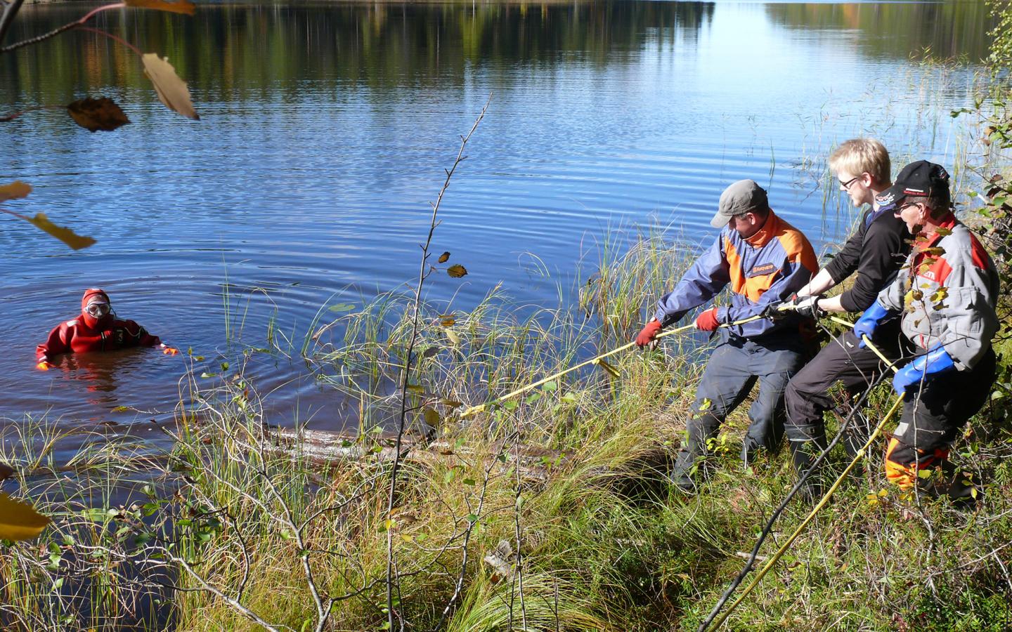
Volcanoes and a Roman Climate Crisis Volcanic eruptions in the Roman period led to climate anomalies affecting the whole northern hemisphere, according to new research. The years 536 CE and 541 – 544 CE experienced a reduction in natural light which would have made human survival much more difficult, the researchers from the Chronology Laboratory of the Finnish Museum of Natural History and Natural Resources Institute Finland (Luke) claim. Farming and animal husbandry would have been adversely affected by the reduction in sunlight, while humans would have been more prone to disease due to a lack of vitamin D. “Our research shows that the climate anomaly, which covered all of the northern hemisphere, was the compound result of several volcanic eruptions,” says Markku Oinonen, director of the Chronology Laboratory. Published in the Journal Scientific Reports, the new research is based on dendrochronology, also known as tree ring dating. The researchers analysed the variation in carbon isotopes in the annual growth rings of trees. The isotopes reflect the photosynthesis of the trees, which is largely dependent on the amount of solar radiation available in summer. “Researchers have put together an annual growth ring calendar of treeline pine spanning more than 7,600 years. Various historical events can be contrasted with the calendar. The growth ring calendar is an important indicator of global climate change,” says researcher Samuli Helama from Luke. Significantly, the years of unusually poor sunlight coincided with bubonic plague epidemic that ravished the Roman Empire. Starting in 542CE, the plague is believed to have killed around 50% of the inhabitants of the Eastern Roman Empire. From its beginnings, the devastating plague spread in western Europe and as far north as Finland, killing millions. Sulawesi Younger than Thought The unique island of Sulawesi is not as old as typically thought, new research is claiming. Located in the interface between Eurasia and Australasia, Sulawesi is home to myriad unique flora and fauna, such as the ‘deer-pig’ (Sulawesi Babirusa), ‘warty pig’ and the ‘miniature buffalo.’ Researchers from Oxford University’s Department of Archaeology and Queen Mary University of London used a combination of morphological and genetic data, alongside geological reconstructions of the island to gain a better understanding of the origins of the island’s fauna. Based on over a thousand samples, the scientists claim it is the largest ever genetic study of the island’s species. It was found that each species most likely arrived on what is now Sulawesi at different times over the past 13 million years, but all of them began to spread across the island simultaneously about 1-2 million years ago. According to the study, this coincides with geological evidence for the emergence of the arms of the island from the ocean. [caption id="attachment_8588" align="alignnone" width="512"]Location of Sulawesi Location of Sulawesi (Celebes), Indonesia, Public Domain[/caption] “Sulawesi is an amazing island, unlike any other on Earth. The key link between the three large mammals in this study is that none of them fly. Sulawesi has been an island for a long time so however they arrived, they have been evolving in isolation,” Professor Greger Larson, Director of Palaeogenomics & Bio-Archaeology Research Network at Oxford and senior author of the study. “Understanding their evolutionary history was only possible by looking not only at their genetic signatures but also the geologic history of the island. The whole region is highly tectonic and we were able to reconstruct how much of the island was under water and when. “Using a molecular clock we were then able to date the time of the expansion of all three species and by correlating those dates with the appearance of the different land masses that make up Sulawesi, we found a perfect temporal match.” Laurent Frantz, Lecturer in Molecular Genetics and Informatics at the Queen Mary University of London, said: ‘Following his famous explorations, Alfred Wallace described Sulawesi as anomalous, first noting the merging of two immensely different worlds on this island. For a long time, we thought these anomalous ecosystems slowly assembled over tens of millions of years, as continents drifted. Yet, we now know that very recent geological processes, over only the last few million years, dramatically shaped this singular tropical paradise.” Ancient Egyptian Papyrus Reveals Sexual Assault A 3,000-year-old Ancient Egyptian papyrus contains some of the oldest evidence of a man being accused of sexual assault, The Independent reports. Dubbed Papyrus Salt 124, the text lists alleged indiscretions by an artisan called Paneb, who lived in Thebes around 1200BCE. Paneb was the chief foreman of a community of artisans who built royal tombs in the ancient city, according to The Independent. The papyrus is authored by someone called Amennakht. It was sent to an official of the Pharaoh, and lists a series of complaints against Paneb. Although ambiguities in the text make some of the charges unclear, among the accusations are one of rape. Paneb is described as having taken the clothes of a woman called Yemenwaw before “he threw her on top of a wall and violated her.” The papyrus was originally translated into English in 1929, by Jaroslav Cerny. The main accusation in the text is that Paneb bribed his way to the chief foreman job, a position Amennakht was due to inherit. Light was first shed on the remarkable text by Narratively. Featured image: A subfossil tree trunk being lifted out of a lake. Image credit: Samuli Helama / Natural Resources Institute Finland ]]>

Categories
Breaking News

Mass Grave Revealed to be Viking Army Burial – The History News of the Week

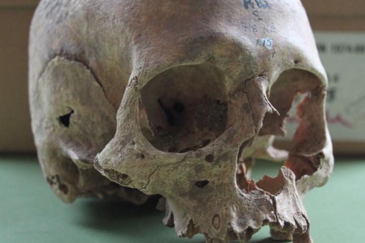
Mass Grave Could be Viking Army Burial A mass grave discovered in the 1980s could be a burial site for the war dead of the Viking Great Army, according to new research. Initial excavations at the site at St Wystan’s Church in Repton, Derbyshire, UK unearthed several Viking graves and a charnel deposit of nearly 300 people underneath a shallow mound in the vicarage garden. Later radiocarbon dating seemed to suggest that the grave consisted of bones collected over several centuries, throwing doubt on whether it was a mass Viking burial. However, the new scientific research, led by Cat Jarman from the University of Bristol, shows that in fact all the bones are consistent with a date in the late ninth century. The mound appears to have been a burial monument linked to the Great Viking Army. According to historical records, the Great Viking Army wintered in Repton in 873 CE, driving the Mercian king into exile. One room of the burial site was packed with the remains of a minimum of 264 people, around 20% of whom were women. Viking weapons and artefacts were found among the remains, including knives, axes and pennies. Mostly aged between 18 and 45 when they died, several of the male sets of remains showed signs of violent trauma. Viking Swords at Bergen museum (2) Jarman and team re-dated the remains, showing that contrary to what the previous carbon dating had suggested, the remains were all consistent with a single date in the ninth century, and the Great Viking Army. Jarman said: “The previous radiocarbon dates from this site were all affected by something called marine reservoir effects, which is what made them seem too old. “When we eat fish or other marine foods, we incorporate carbon into our bones that is much older than in terrestrial foods. This confuses radiocarbon dates from archaeological bone material and we need to correct for it by estimating how much seafood each individual ate.” The study has been published in the journal Antiquity. According to Jarman, the research could be a starting point for learning more about the Great Viking Army. “The date of the Repton charnel bones is important because we know very little about the first Viking raiders that went on to become part of considerable Scandinavian settlement of England. “Although these new radiocarbon dates don’t prove that these were Viking army members it now seems very likely. It also shows how new techniques can be used to reassess and finally solve centuries old mysteries.” Prehistoric Weapons Recreated Archaeologists from the University of Washington have recreated the weapons used by hunter-gatherers in the post-Ice Age Arctic up to 14,000 years ago. Janice Wood, a recent anthropology graduate, and Ben Fitzhugh, a professor of anthropology, reconstructed projectiles and points from ancient sites in what is now Alaska, and studied the qualities that made them effective hunting weapons. Their study, published in the Journal of Archaeological Science, focused on hunting weapons from the earliest archaeological records of Alaska (10,000 to 14,000 years ago), when a range of different projectiles and points were in use. Their study has provided insights into the technological choices made by prehistoric Alaskans. “The hunter-gatherers of 12,000 years ago were more sophisticated than we give them credit for,” Fitzhugh said. “We haven’t thought of hunter-gatherers in the Pleistocene as having that kind of sophistication, but they clearly did for the things that they had to manage in their daily lives, such as hunting game. They had a very comprehensive understanding of different tools, and the best tools for different prey and shot conditions.” Wood travelled to the area around Fairbanks, Alaska, and crafted 30 projectile points of various kinds, staying as close to the original materials and manufacturing processes as possible. Projectiles were made from poplar, with birch tar used as an adhesive to affix the points to the tips of the projectiles. The anthropologist then tested how well each point could penetrate and damage two different targets: blocks of ballistic gelatin (a synthetic gelatin meant to mimic animal muscle tissue), and a fresh reindeer carcass purchased from a local farm. Instead of an atlatl, a kind of throwing board used by ancient Alaskans, Wood used a maple recurve bow to shoot the arrows. Three different types of point were tested: composite microblades, stone and bone. It was found that the microblades were more effective on smaller prey, due to their versatility and ability to inflict more damage. The bone points penetrated more deeply and created narrower wounds, suggesting they could be used to stun larger prey such as bison. The stone points could have cut wider wounds, especially on larger prey, resulting in quicker kills.Iceage Weapon or Tool For Wood, these findings show that the hunter-gatherers were sophisticated enough to recognise which points to use and when. “We have shown how each point has its own performance strengths. It has to do with the animal itself; animals react differently to different wounds. And it would have been important to these nomadic hunters to bring the animal down efficiently. They were hunting for food.” The authors believe that the research could also shed new light on debates over whether human hunting practices could have led to the extinction of certain species. “I see this line of research as looking at the capacity of the human brain to come up with innovations that ultimately changed the course of human history,” she said. “This reveals the human capacity to invent in extreme circumstances, to figure out a need and a way to meet that need that made it easier to eat and minimised the risk.” History of Dice Revealed in New Study New research has charted the history and development of dice, revealing how they’ve changed over the last 2,000 years to become unbiased, with every number having an equal probability of being rolled. The research was led by Jelmer Eerkens, professor of anthropology at the University of California, Davis. It reveals that in the Roman era, many dice were lopsided, in contrast to the perfect cubes seen today. It also highlights that Roman dice varied drastically in shape, size, material and the configuration of numbers. Between 400 CE and 1100 CE, dice are apparently extremely rare in the archaeological record, corresponding with the Dark Ages. According to Eerkens and colleagues’ research, a new awareness of the importance of form in dice became apparent around 1450, reflecting the onset of the Renaissance. “A new worldview was emerging — the Renaissance. People like Galileo and Blaise Pascal were developing ideas about chance and probability, and we know from written records in some cases they were actually consulting with gamblers,” he said. “We think users of dice also adopted new ideas about fairness, and chance or probability in games.” “Standardising the attributes of a die, like symmetry and the arrangement of numbers, may have been one method to decrease the likelihood that an unscrupulous player had manipulated the dice to change the odds of a particular roll,” Eerkens continued. Eerkens and his co-author, Alex de Voogt of the American Museum of Natural History, looked at hundreds of dice in museums and archaeological depots across the Netherlands, assembling a set of 110 carefully dated, cube shaped dice to analyse. For Eerkens, dice present a fascinating artefact for archaeologists, embodying shifting worldviews. “In this case, we believe it follows changing ideas about chance and fate.” The study has been published in the journal Acta Archaeologica. Featured image is one of the female skulls from the Repton charnel. Image credit: Cat Jarman]]>

Categories
Breaking News

Caesar's Landing in Britain – The History News of the Week

Site of Julius Caesar’s Invasion of Britain Discovered Archaeologists have discovery the first evidence of Julius Caesar’s invasion of England. Based on their findings, the archaeologists from the University of Leicester suggest the first landing of Caesar’s fleet in Britain took place in 54BCE at Pegwell Bay on the Isle of Thanet, at the north-east point of the county of Kent. Significantly, the topography of Pegwell Bay, with its visibility from the sea, large open bay and nearby higher ground, is consistent with Caesar’s account of the first landing. The project came about following the discovery of a large defensive ditch in archaeological investigations prior to the building of a new road close to a hamlet in Thanet. This ditch, in Ebbsfleet, is similar to Roman defences at Alésia in France where the decisive battle in the Gallic War took place in 52 BCE. 4-5 metres wide and 2 metres deep, the ditch has been dated by pottery found on site and radio carbon dating to the first century BCE. The archaeological team believe the site covers up to 20 hectares, and the fort was constructed to protect the ships of Caesar’s fleet that had been drawn up on a nearby beach. Dr Andrew Fitzpatrick, research associate from the University of Leicester’s School of Archaeology and Ancient History, said: “The site at Ebbsfleet lies on a peninsular that projects from the south-eastern tip of the Isle of Thanet. Thanet has never been considered as a possible landing site before because it was separated from the mainland until the Middle Ages. “However, it is not known how big the Channel that separated it from the mainland (the Wantsum Channel) was. The Wantsum Channel was clearly not a significant barrier to people of Thanet during the Iron Age and it certainly would not have been a major challenge to the engineering capabilities of the Roman army.” Fitzpatrick detailed the similarities between Caesar’s account and the Thanet site. “Sailing from somewhere between Boulogne and Calais, Caesar says that at sunrise they saw Britain far away on the left-hand side. As they set sail opposite the cliffs of Dover, Caesar can only be describing the white chalk cliffs around Ramsgate which were being illuminated by the rising sun,” he explained in a press release. “Caesar describes how the ships were left at anchor at an even and open shore and how they were damaged by a great storm. This description is consistent with Pegwell Bay, which today is the largest bay on the east Kent coast and is open and flat. The bay is big enough for the whole Roman army to have landed in the single day that Caesar describes. The 800 ships, even if they landed in waves, would still have needed a landing front 1-2 km wide. “Caesar also describes how the Britons had assembled to oppose the landing but, taken aback by the size of the fleet, they concealed themselves on the higher ground. This is consistent with the higher ground of the Isle of Thanet around Ramsgate. “These three clues about the topography of the landing site; the presence of cliffs, the existence of a large open bay, and the presence of higher ground nearby, are consistent with the 54 BCE landing having been in Pegwell Bay.” Sea Level Rises Threatening 13,000 US Archaeological Sites Rising sea levels could impact thousands of archaeological sites on the southeastern US Gulf and Atlantic coasts, new researched published in the journal PLOS ONE claims. David Anderson from the University of Tennessee, Knoxville, USA, and colleagues predict that if projected trends in sea level rises continue, up to 13,000 recorded archaeological sites will be submerged by a 1 metre rise in sea level by the end of the century. This figure does not take into account sites that have not yet been unearthed, suggesting the damage could be even greater. To estimate the impact of sea-level rises, Anderson and his team studied data from the Digital Index of North American Archaeology (DINAA). DINAA aggregates archaeological and historical data sets from the past century from numerous sources, providing a comprehensive insight into the history of human settlement. According to a University of Tennessee statement, large linked data sets like DINAA are vital for showing what is at threat from sea level rises, and can help in planning a response, whether it be mitigation, or taking samples from sites that are at risk. “Sea-level rise in the coming years will destroy vast numbers of archaeological sites, buildings, cemeteries, and cultural landscapes. Developing informatics capabilities at regional and continental scales like DINAA (Digital Index of North American Archaeology) is essential if we are to effectively plan for, and help mitigate, this loss of human history,” Anderson noted. Secrets of 1-900-Year-Old Mummy Revealed With X-Rays Scientists are using pioneering techniques to unravel the mysteries of a young girl mummified in Egypt 1,900 years ago. The mummy was subjected to an all-day X-ray scattering experiment at the Argonne National Laboratory by scientists and students from Northwestern University. It was the first time the technique had been applied to study a human mummy. “This is a unique experiment, a 3-D puzzle,” said Stuart R. Stock, research professor of cell and molecular biology at Northwestern University Feinberg School of Medicine, who led the synchrotron experiment. “We have some preliminary findings about the various materials, but it will take days before we tighten down the precise answers to our questions. We have confirmed that the shards in the brain cavity are likely solidified pitch, not a crystalline material.” The Roman-Egyptian mummy is one of only approximately 100 portrait mummies in the world. Portrait mummies have a lifelike painting of the deceased individual on the mummy wrappings, directly over the deceased’s face. These ‘2D portraits’ were introduced to Egyptian culture by the Romans. Previously, idealised 3D images had been used, such as the iconic burial mask of Tutankhamun. Measuring just 3 feet in length, the girl’s body is swaddled in linen. The outer wrappings have been arranged into an ornate geometric pattern. The image of the face is painted with beeswax and pigment. It gazes outward with a serene look, the body dressed in a crimson tunic and gold jewellery. The students from Northwestern University found that the mummy of the girl, which is stored at Garrett-Evangelical Theological Seminary on Northwestern’s Evanston campus, had notable differences to portrait mummies at Phoebe A. Hearst Museum of Anthropology at the University of California, Berkeley. This suggests it came from a different workshop despite being discovered at the site of Hawara, close to Tebtunis, where the Hearst Museum’s mummy portraits are originally from. “Intact portrait mummies are exceedingly rare, and to have one here on campus was revelatory for the class and exhibition,” said Marc Walton, a research professor of materials science and engineering at Northwestern’s McCormick School of Engineering. As well as providing insights into Egyptian-Roman mummification techniques, the ground-breaking studies being carried out by Northwestern University will help guide preservation of the mummy. The research will culminate in an exhibition at Block Museum titled: “Paint the Eyes Softer: Mummy Portraits from Roman Egypt.” Featured image: The Ebbsfleet Excavation with Pegwell Bay and Ramsgate. Image courtesy of University of Leicester. ]]>

Categories
Breaking News

History News of the Week – USS Indianapolis Discovered

USS Indianapolis Shipwreck Discovered 72 years after its sinking, the wreckage of the USS Indianapolis has been discovered 18,000 feet beneath the surface of the Philippine Sea, according to the New York Times. In July 1945, in the final months of the Second World War, the USS Indianapolis was sunk by a Japanese torpedo, as it returned from a secret mission to deliver parts that were used in the atomic bomb dropped on Hiroshima. The ship’s sinking was the worst loss of life in the history of the US Navy. Of the 1,196 crew on board, just 316 were rescued. Although somewhere between 800 and 900 people escaped the sinking ship, no distress signal was sent. When the survivors were found by chance four days later in shark infested waters, just a fraction were left alive. On Saturday 19th September, a civilian team led by Paul G. Allen, the co-founder of Microsoft, announced that it had found unmistakable wreckage of the Indianapolis. They had been directed to the site by new research from a naval historian which determined a specific region of the ocean where the ship had been sited the night before its destruction. “To be able to honour the brave men of the USS Indianapolis and their families through the discovery of a ship that played such a significant role during World War Two is truly humbling,” Allen told the BBC. Ancient Pompeii’s Water Supply was Poisonous New research claims that the water transported through the pipelines of the ancient Roman city of Pompeii was probably poisonous on a scale that would have likely led to diarrhea, vomiting and liver and kidney damage for anyone who drank it. Kaare Lund, a chemist from the Southern University of Denmark (SDU), analysed water pipes from Pompeii and found high levels of the toxic element antimony, which he believes may have poisoned the drinking water. Antimony is acutely toxic, meaning it causes a quick reaction in anyone who consumes it. According to a statement from SDU, the element is particularly irritating to the bowels, and the reactions are excessive vomiting and diarrhea that can lead to dehydration. In severe cases it can also affect the liver and kidneys and, in the worst-case scenario, can cause cardiac arrest. Pompeii’s location, close to Mount Vesuvius, likely meant the concentration of antimony was higher there than elsewhere in the Roman Empire, as the toxic chemical element naturally occurs in groundwater close to volcanoes. Lund and colleagues’ findings have been published in the journal Toxicology Letters. Hannibal’s defeat and the rise of Rome written in coins Chemical analysis of Roman coins has found that the defeat of Hannibal led to a flood of wealth through the Empire from the silver mines of Spain. According to scientists, the discovery tracks Rome’s transition from regional power to empire. Regarded as a key event in European history, the Second Punic War saw Hannibal lead his formidable Carthaginian army across the Alps in 218 BCE in a failed assault on Rome. Hannibal’s defeat saw the Romans conquer the Iberian Peninsula, with the Romans slowly gaining control over the region’s lucrative silver mines circa 211 BCE. War reparations from Carthage combined with the revenue taken from the Spanish mines ultimately funded Rome’s rapid territorial expansion. The new geochemical analysis has now provided clear proof of the importance of the Spanish silver in funding Roman conquest. A group of scientists based in Germany and Denmark and led by Prof Fleur Kemmers and Dr Katrin Westner (Institute for Archaeological Sciences, Goethe University, Frankfurt) analysed 70 Roman coins dating from 310-300 BCE to 101 BCE, the period surrounding the Second Punic War. Using Mass Spectrometry, the team determined that the lead in the coins from after 209 BCE had distinctive isotope signatures which identified them as presumably originating from Spain. “Before the war we find that the Roman coins are made of silver from the same sources as the coinage issued by Greek cities in Italy and Sicily2. In other words the lead isotope signatures of the coins correspond to those of silver ores and metallurgical products from the Aegean region”, said Katrin Westner. “But the defeat of Carthage led to huge reparation payments to Rome, as well as Rome gaining high amounts of booty and ownership of the rich Spanish silver mines. From 209 B.C. we see that the majority of Roman coins show geochemical signatures typical for Iberian silver”. “This massive influx of Iberian silver significantly changed Rome’s economy, allowing it to become the superpower of its day. We know this from the histories of Livy and Polybius and others, but our work gives contemporary scientific proof of the rise of Rome. What our work shows is that the defeat of Hannibal and the rise of Rome is written in the coins of the Roman Empire.” ]]>

Categories
Breaking News

Attila The Hun Integrated as Well as Obliterated on the Roman Frontier

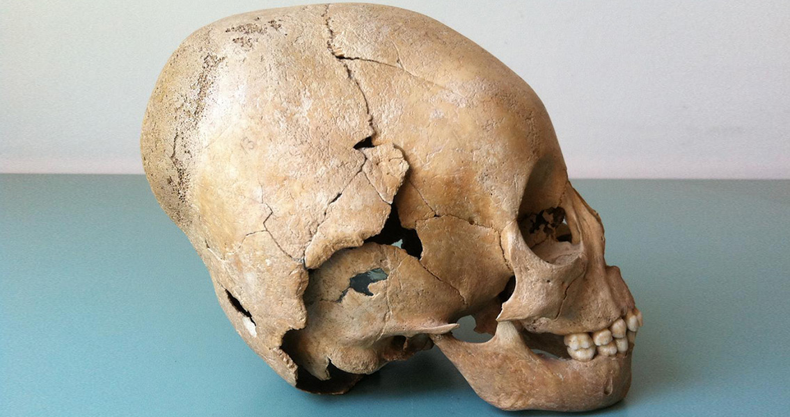
PLOS ONE, the new study from the University of Cambridge looks at fifth century gravesite remains in the Roman frontier of Pannonia (in what is now Hungary) to reveal how ordinary people might have dealt with the arrival of the Huns. One remarkable discovery points to the Huns recruiting from the Roman frontiers. Biochemical analyses of teeth and bones suggest some farmers gave up their homesteads on the edge of the Roman Empire to become roaming herdsmen like the Huns. This raises the possibility that some of these farmers may have taken up arms and fought for the Hun tribes. The cultural exchange between Huns and farmers was far from a one way process, however. Nitrogen and carbon isotopes in remains can allow researchers to distinguish between agricultural and pastoral diets. Based on this, the team found a significant dietary shift in some sets of remains, suggesting that some Huns gave up on their nomadic lifestyle and elected to settle into an agricultural one. According to lead researcher Dr Susanne Hakenbeck, the Huns may have introduced farmers to ways of life some found appealing, but they also learnt from and occasionally settled among the locals. “We know from contemporary accounts that this was a time when treaties between tribes and Romans were forged and fractured, loyalties sworn and broken. The lifestyle shifts we see in the skeletons may reflect that turmoil,” said Hakenbeck, in a press release. “However, while written accounts of the last century of the Roman Empire focus on convulsions of violence, our new data appear to show some degree of cooperation and coexistence of people living in the frontier zone. Far from being a clash of cultures, alternating between lifestyles may have been an insurance policy in unstable political times.” Hakenbeck’s team analysed the carbon, nitrogen, strontium and oxygen isotopes of bones and teeth from the fifth century graves in Hungary. Those were then compared with sites in Germany known to have been home to typical farmer communities, and sites in Siberia and Mongolia known to have been home to nomadic herders. Unlike the other sites, Pannonia showed signs of both nomadic and agricultural lifestyles, as well as individuals that switched between the lifestyles during their life times. “The exchange of subsistence strategies is evidence for a way of life we don’t see anywhere else in Europe at this time,” said Hakenbeck. The results paint a picture of the Hun incursions markedly different to those offered by Roman authors from the period. As Hakenbeck explained: “While Roman authors considered them incomprehensibly uncivilised and barely human, it seems many citizens at the edge of Rome’s empire were drawn to the Hun lifestyle, just as some nomads took to a more settled way of life” . Image courtesy of Susan Hakenbeck ]]>

Categories
Breaking News

The First Gate Ever Found at a Jewish Town Named for Gates

Times of Israel. The town’s affluence could have served as a reason for the heightened security. Beit She’arim was the home to many prominent and wealthy Jews, so the community might have been named from the fortifications built to keep them safe. Another possibility is that it was the site of an important Roman fortress. Erlich and her team have plans to return and continue excavations at both Beit Zaid and Beit She’arim next season. ]]>

Categories
Breaking News

How Ancient Roman Chariots Were Kept From Crashing

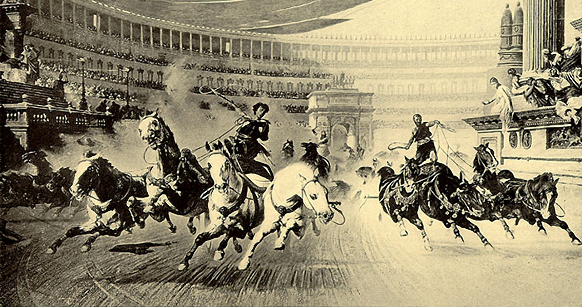
Seeker. “Any iron tire for racing would be a very thin strip of iron on the outside of the wooden rim, best when heat-shrunk on the wood, to consolidate the whole wheel. The solution makes full sense in engineering thinking, ancient or modern.” Horse and chariot races were part of the sacred games, known as ludi, which were held during archaic Roman festivals. The race’s sacral meaning, although diminished across time, has been preserved by the iconography found at Rome’s primary racetrack, the Circus Maximus. No actual Roman chariots are known to have survived. The small toy model, currently being displayed at the British Museum, is the only archaeological evidence for the reinforced single-tire design. The bronze, hand-sized model represents a biga, a racing chariot with two wheels, driven by two horses. The model is missing the charioteer as well as one of the horses and was likely a toy for a prosperous individual, possibly even Emperor Nero himself who, according to historians, played with toy chariots. “The wheels originally rotated freely on the axle. It was made by someone who knew a lot about racing chariots,” Sandor says in the article. Given that it’s easier to guide horses into left-turns, a majority of chariot races ran counter-clockwise. Therefore, chariots’ had only the right wheels strengthened because the chariots naturally leaned right, overloading the right wheel during left-hand turns. The single tire reinforcement configuration didn’t always mean a faster chariot, however, it may have prevented the wheel from failing, consequently reducing crashes. This alone made it statistically superior on the racetrack. In general, Sandor estimates that the chariots with no iron tires had a 50 percent chance of winning, while vehicles with two iron tires would only win 30 percent of the time. The study, which has been published in the Journal of Roman Archaeology, found that a racing chariot with one iron tire on the right was the best design in regards to durability, safety and chance of winning. ]]>

Categories
Editorial

Herod: City Builder and Child Killer

Categories
News

A History of the Christmas Tree From Paganism to Shopping Centres